


Lupton Voting District, Apache County, Arizona
About
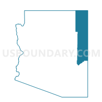
Outline

Summary
| Unique Area Identifier | 523624 |
| Name | Lupton Voting District |
| County | Apache County |
| State | Arizona |
| Area (square miles) | 133.80 |
| Land Area (square miles) | 133.74 |
| Water Area (square miles) | 0.06 |
| % of Land Area | 99.95 |
| % of Water Area | 0.05 |
| Latitude of the Internal Point | 35.29958820 |
| Longtitude of the Internal Point | -109.09590290 |
Maps


Graphs
Select a template below for downloading or customizing gragh for Lupton Voting District, Apache County, Arizona


Neighbors
Neighoring Voting District (by Name) Neighboring Voting District on the Map
- Houck Voting District, Apache County, AZ
- McKinley County Precinct 22, McKinley County, NM
- McKinley County Precinct 25, McKinley County, NM
- McKinley County Precinct 27, McKinley County, NM
- Oak Springs Voting District, Apache County, AZ
- Puerco East Voting District, Apache County, AZ
Top 10 Neighboring County Subdivision (by Population) Neighboring County Subdivision on the Map
- Red Rock CCD, McKinley County, NM (24,280)
- Fort Defiance CCD, Apache County, AZ (23,325)
- Zuni CCD, McKinley County, NM (7,881)
- Puerco CCD, Apache County, AZ (2,499)
Top 10 Neighboring Place (by Population) Neighboring Place on the Map
Top 10 Neighboring Unified School District (by Population) Neighboring Unified School District on the Map
- Gallup-Mckinley County Schools, NM (63,611)
- Window Rock Unified District, AZ (11,846)
- Zuni Public Schools, NM (7,881)
- Sanders Unified District, AZ (5,899)
Top 10 Neighboring State Legislative District Lower Chamber (by Population) Neighboring State Legislative District Lower Chamber on the Map
- State House District 2, AZ (177,904)
- State House District 6, NM (27,357)
- State House District 9, NM (26,110)
Top 10 Neighboring State Legislative District Upper Chamber (by Population) Neighboring State Legislative District Upper Chamber on the Map
Top 10 Neighboring 111th Congressional District (by Population) Neighboring 111th Congressional District on the Map
- Congressional District 1, AZ (774,310)
- Congressional District 3, NM (693,284)
- Congressional District 2, NM (663,956)
Top 10 Neighboring Census Tract (by Population) Neighboring Census Tract on the Map
- Census Tract 9439.01, McKinley County, NM (4,845)
- Census Tract 9439.02, McKinley County, NM (4,238)
- Census Tract 9450.02, Apache County, AZ (3,916)
- Census Tract 9451, Apache County, AZ (2,221)
- Census Tract 9457, McKinley County, NM (2,197)
- Census Tract 9405, McKinley County, NM (1,422)
Top 10 Neighboring 5-Digit ZIP Code Tabulation Area (by Population) Neighboring 5-Digit ZIP Code Tabulation Area on the Map
- 87301, NM (23,674)
- 87305, NM (3,350)
- 86512, AZ (2,439)
- 87319, NM (1,832)
- 87326, NM (1,688)
- 86506, AZ (1,321)
- 86508, AZ (752)